“Flying High In Florida captured our waterfront listing perfectly. The drone shots helped us sell in days, not weeks.”
— Mark R., Crystal River
Real stories from Florida’s sky-high perspectives. (Zoey approves these messages 🐾)
“Flying High In Florida captured our waterfront listing perfectly. The drone shots helped us sell in days, not weeks.”
— Mark R., Crystal River
“Jason & Kathleen delivered gorgeous event footage—crisp, cinematic, and perfectly timed to the music. Crowd went wild.”
— Lisa T., Hernando Beach
“Professional, creative, and fast turnarounds. The aerials gave our listing that ‘Florida wow’ buyers crave.”
— John D., Realtor, Dunnellon
Part 107 certified • Fully insured • Serving Florida’s Nature Coast & beyond


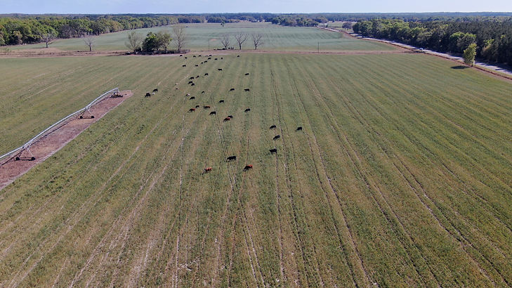
Aerial-based thermal imaging has also become an important tool for agricultural management. It is a non-invasive way to monitor crops, nurseries and greenhouses and even detect plant disease.
Aerial assessments and data gathering within the farming sector provides key information such as:
Plant Vigor
Plant Stress
Plant Counts
Field Uniformity
Plant Height
Other Variables
This information can be used to predict the need for fertilizer inputs, irrigation modifications, peak harvest, overall crop health, and ultimate, crop yield/value. Industrial farmers can now leverage these technologies, since they allow for better business decisions relating to agricultural issues.
Our vigor assessment isolates areas where vegetation is lacking, or experiencing some form of stress. Using this imagery, growers can identify areas requiring immediate action and create a treatment plan, resulting in reduced application costs and increased yields.
Quickly identify area of stress
Review ground-truth with your agronomist
Convert agronomist diagnosis into an action plan


